Is hiking the Path of Gods on your Amalfi Coast bucket list? This incredible trail is absolutely worth your time. But the logistics can be a bit challenging – so I pulled together the quick guide with everything you need to know about hiking the famous Path of Gods.
Heading to the Amalfi Coast usually conjures up images of sun-soaked beaches, lemon groves, and quaint, colorful towns perched on cliffs. But there’s another gem that deserves a spot on your itinerary – the Path of the Gods hike. Or Sentiero Degli Dei, in Italian.
Tucked away from the hustle and bustle of the major tourist towns, this trail offers breathtaking views, a serene atmosphere, and a taste of the natural beauty that the Amalfi Coast is blessed with.
Here’s everything you need to know to hike the famous Path of the Gods!
The Hike (Distance, Terrain, and other Important Details)
Quick Facts:
Distance: 3.6 miles (5.8 km)
Estimated Time to Complete: 2 – 2 1/2 hours
Elevation Gain: ~720 feet (220meters)
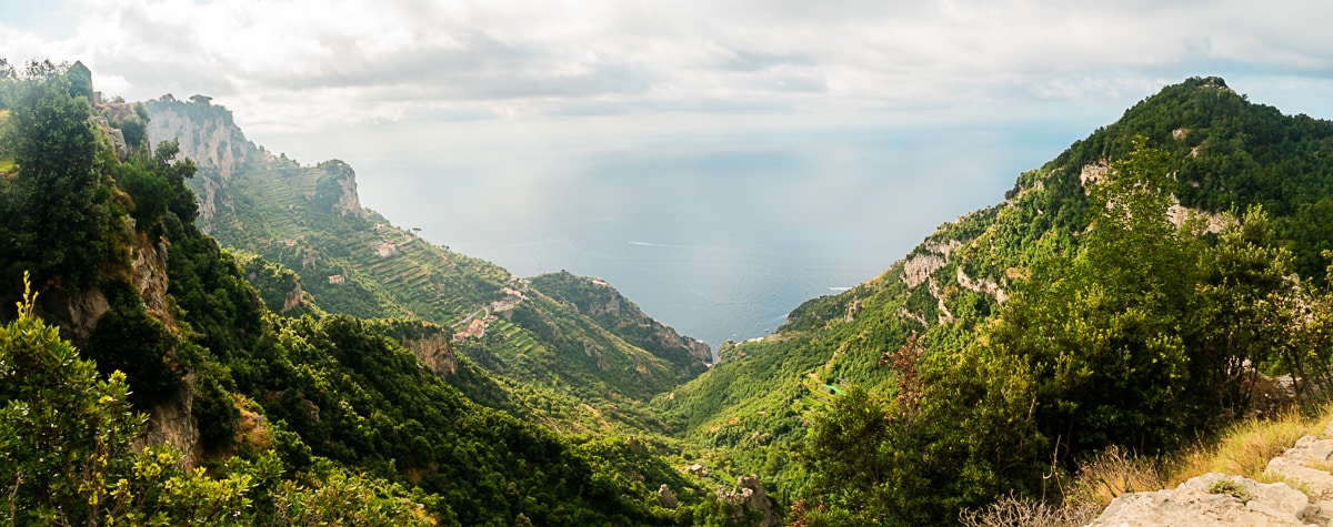
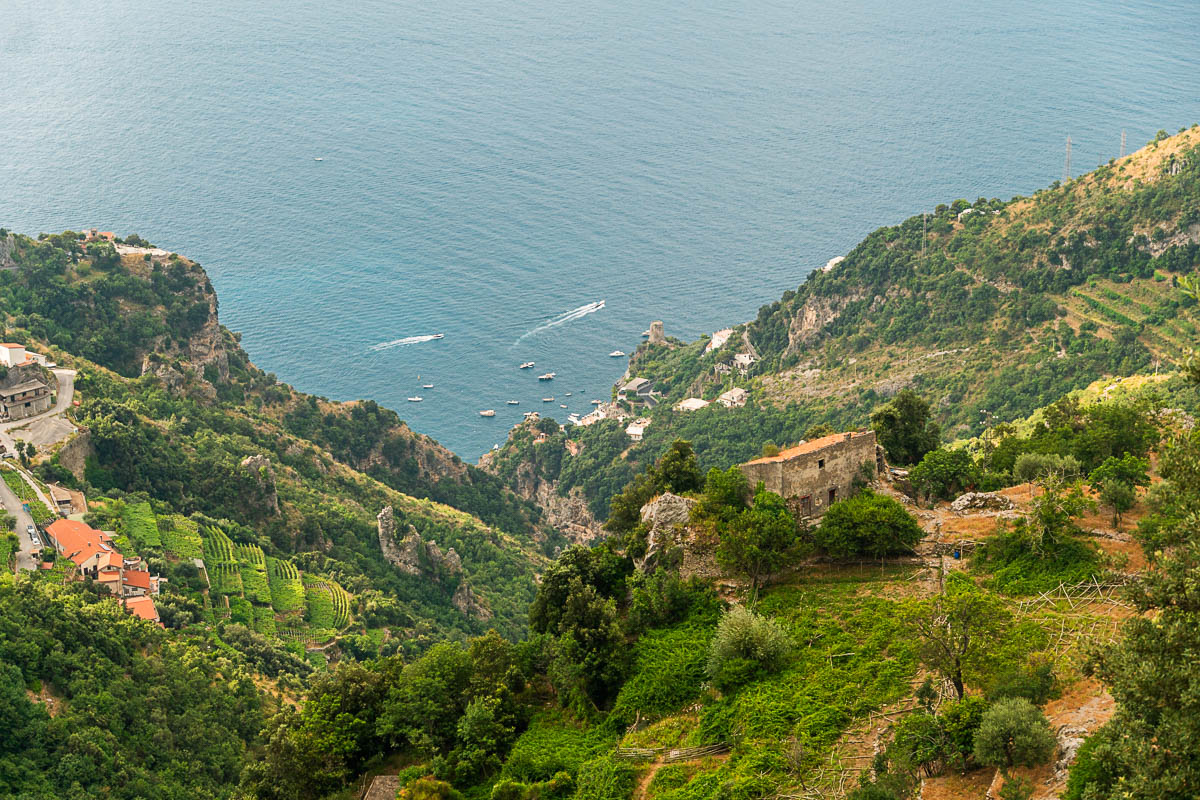
The Path of Gods is a 3.6 mile trail that winds through the cliffs above the Amalfi Coast, stretching from the small town of Bomerano to the even smaller town of Nocelle.
It’s often considered one of the best hiking trails in the world, thanks largely to the absolutely stunning views of the coastline and sparkling blue waters. And yes – it is every bit as beautiful as they say it is.
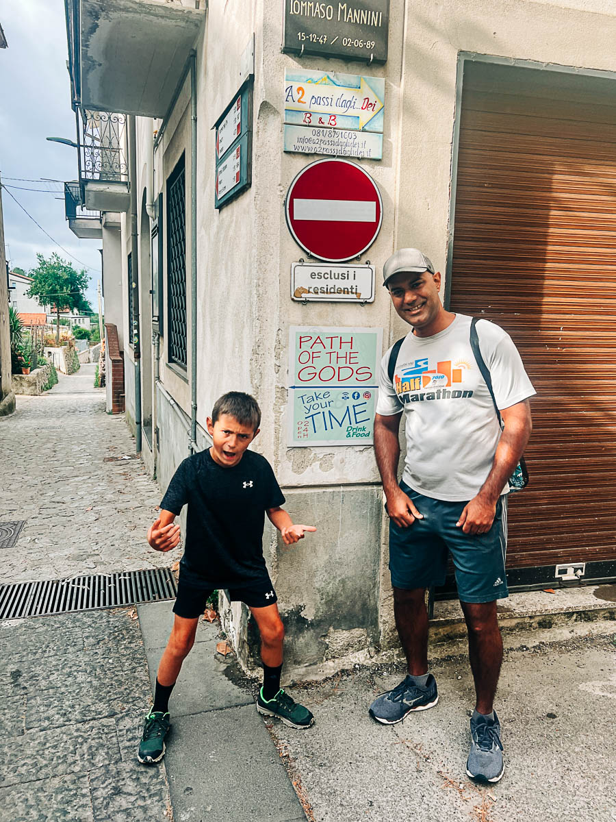
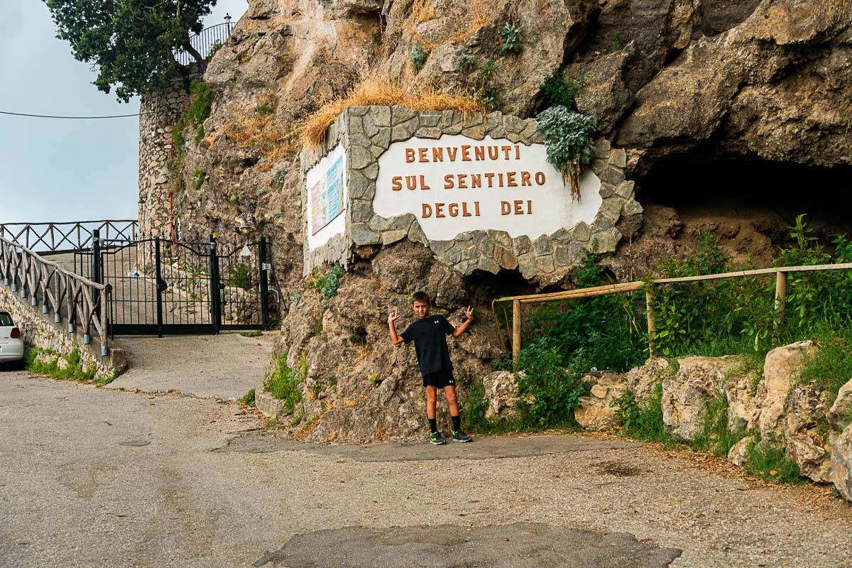
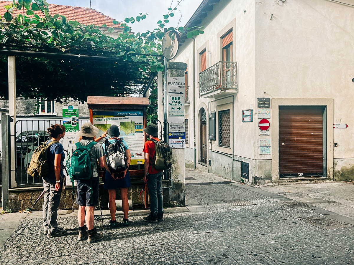
You’ll start off in the small town of Bomerano, where you will have a short walk (about 1/2 mile) to reach the official trailhead. (Note that is not counted in the 3.6 miles listed above). You’ll pass through a little wooded area and up some steps to the road above. Don’t worry – there are plenty of signs to get you to the right place!
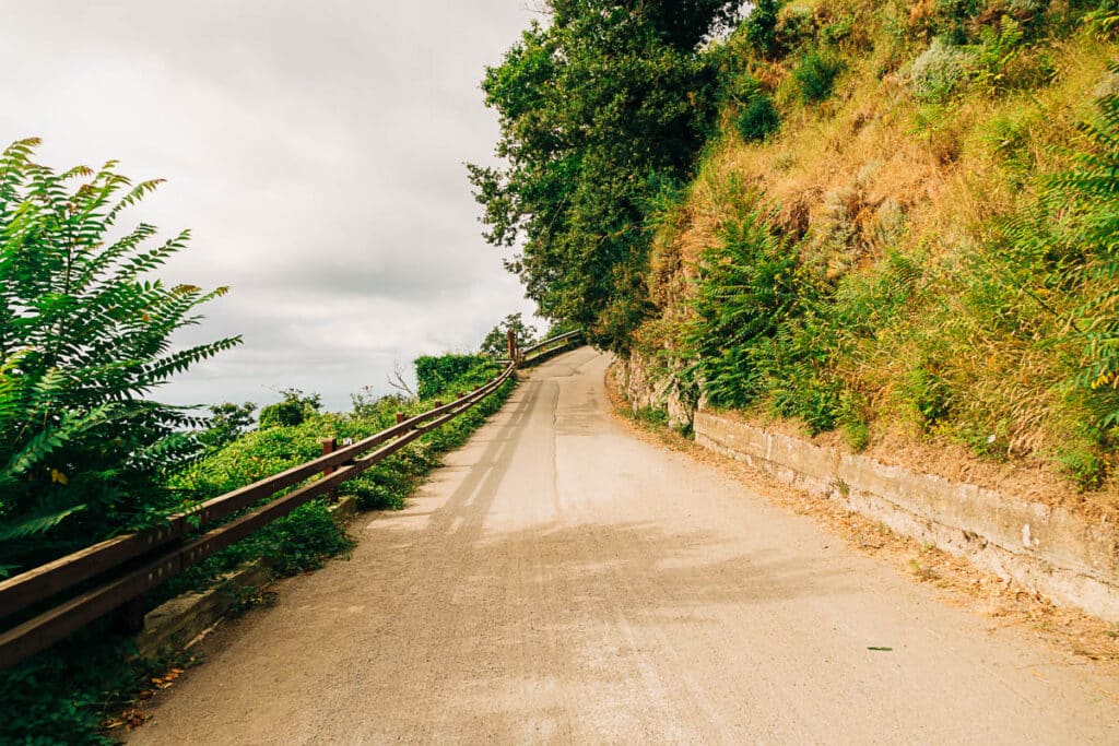
And you are immediately greeted with some pretty stunning views. This is the view from the road above, before we’ve even reached the trail. How gorgeous is that?!
At the end of that road, you will find the entrance to the Path of Gods. There it is! This is where the 3.6 mile trail actualaly starts – the walk so far has all been a bonus. ;) And so we officially set off on our hike.
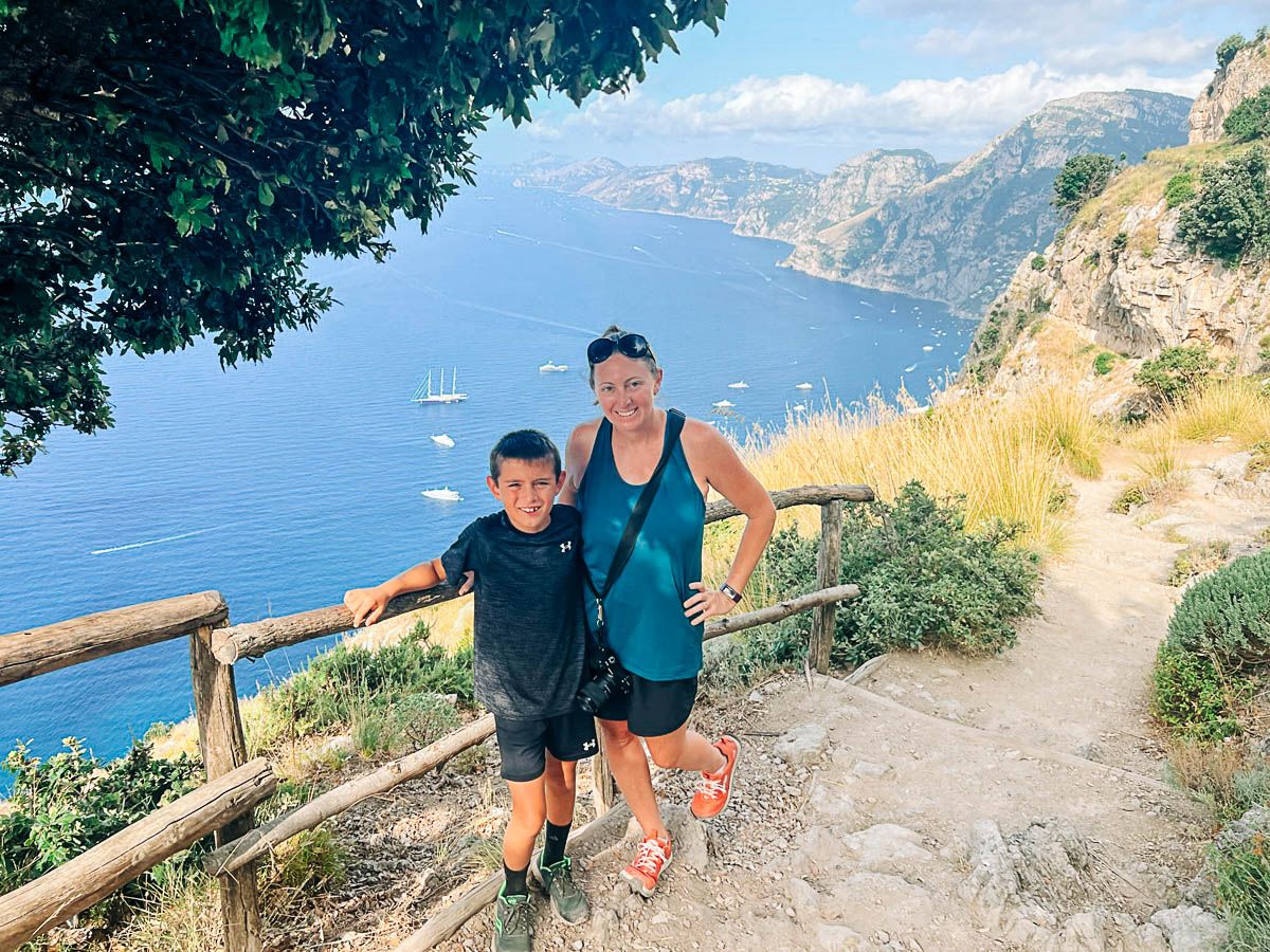
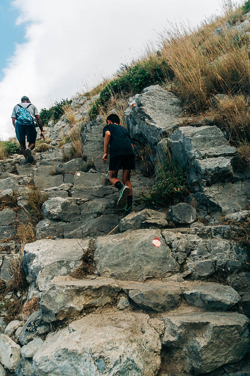
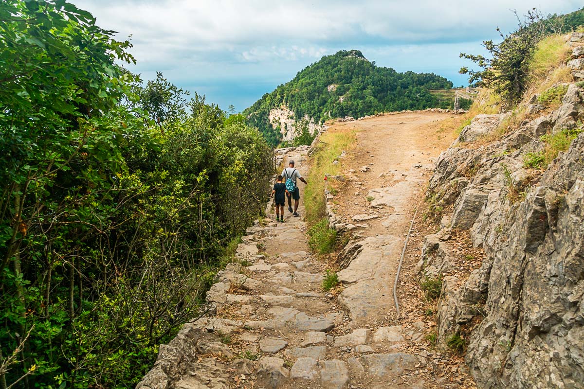
The trail itself is not too difficult. In many parts, it’s simply a dirt pathway, like what you see me and my son standing on in the picture below. And even the uphill areas often have terraced steps carved in, making it more of a walk than a hike.
But there are definitely a few areas that are more rocky, which helps give this trail it’s “moderate” difficulty rating. Here’s an example below of one of the rockier areas of the trail. Note the steep drops offs along the sides of the pathway. This was fine for my son, but could be trickier with much younger kids!
I think this was the steepest area of them all ( in the picture below)! This was just a very small section and was the closest thing to “rock scrambling” we had to do on this hike. Of course, this was also my kid’s favorite part.
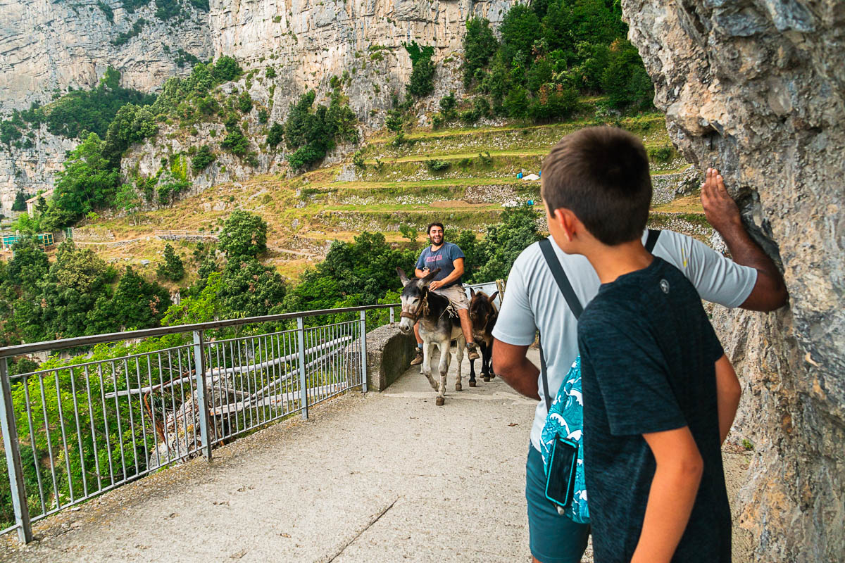
If you’re lucky, you might even pass a donkey or two along the way! If you do encounter any horses or donkeys on the trail, simply step to the side (whichever side is safer) and let them pass by. Believe it or not, there are still homes and even some business tucked into these rocky cliffs – and the mules are often the only way to transport goods there!
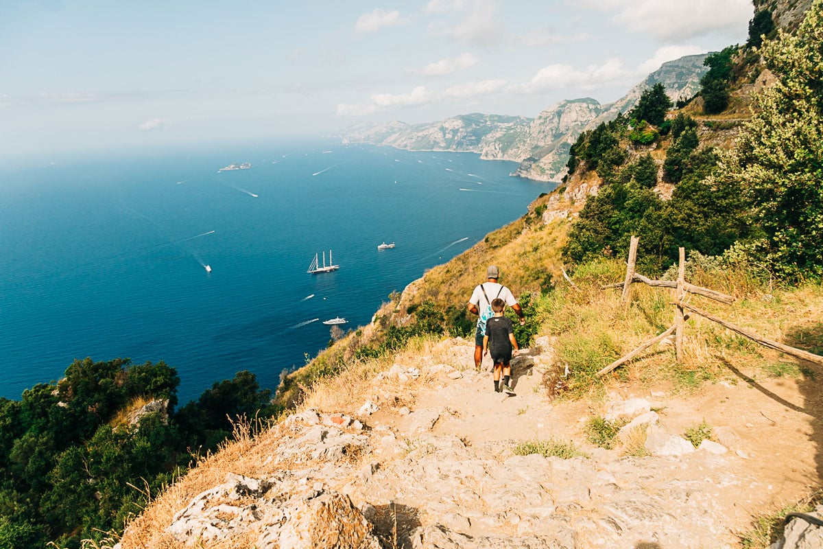
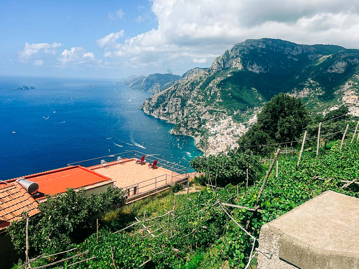
And of course – the views from everywhere are spectacular! It just gets more stunning at every turn. Seriously – look at that water. It’s like a fairy tale.
And eventually Amalfi Coast’s most famous city of all – Positano – starts to come into view.
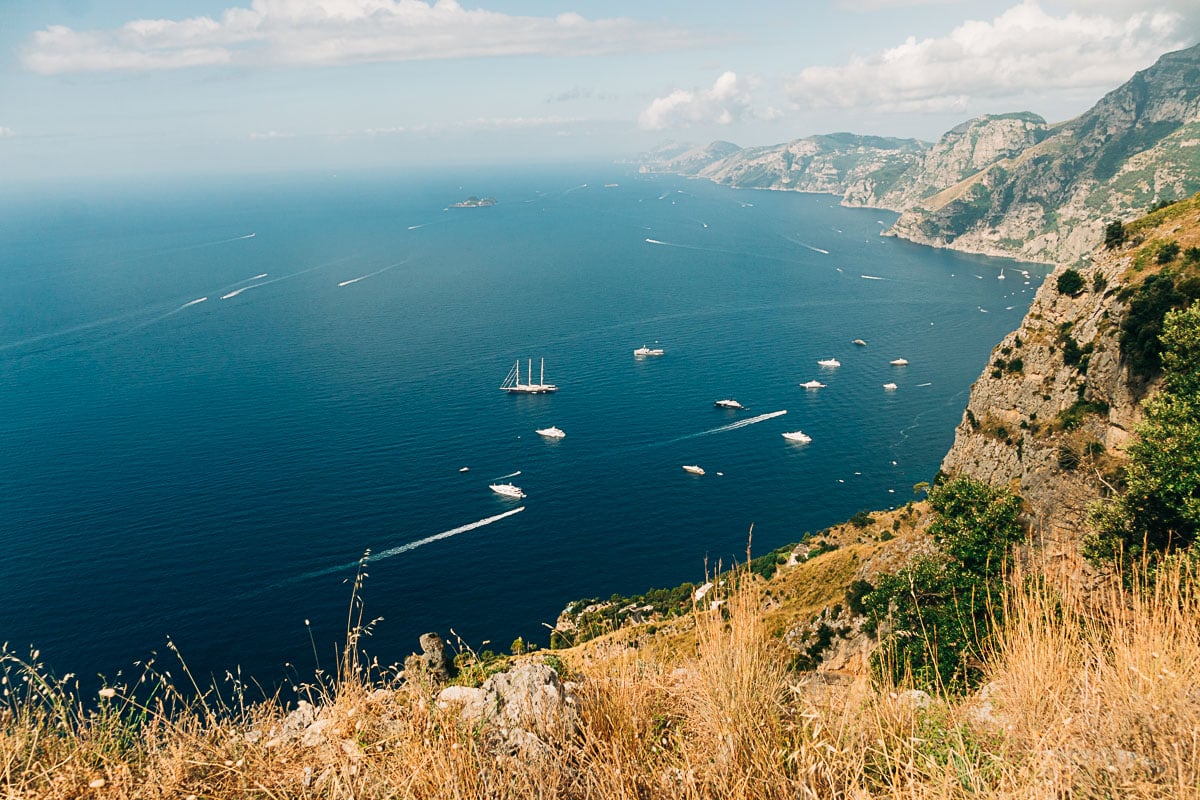
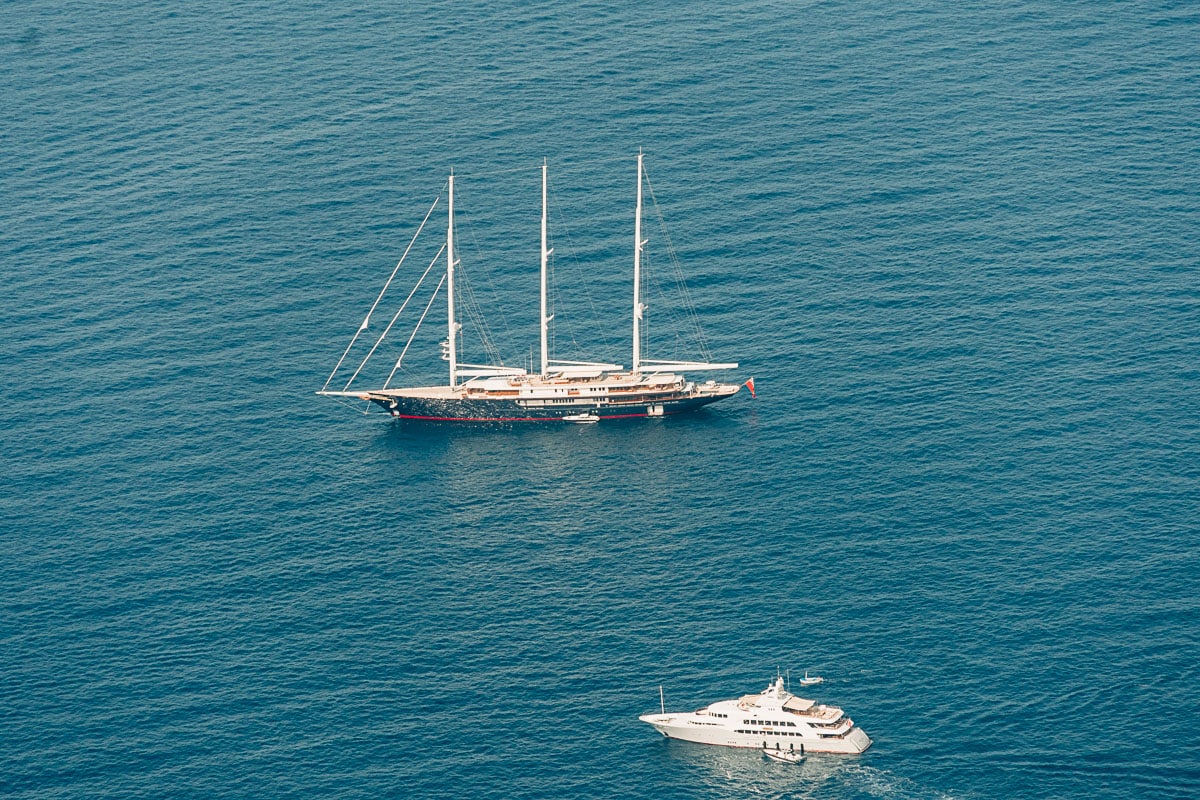
We even caught a glimpse of Jeff Bezo’s yacht! Yes, that’s really it with the three masts. If you don’t believe me, go check out this article about it. The yacht is named Koru, and is so big that it has a second “support yacht” that follows it around.
At the end of the trail, you’ll find yourself walking down a long stone staircase to reach the town of Nocelle.
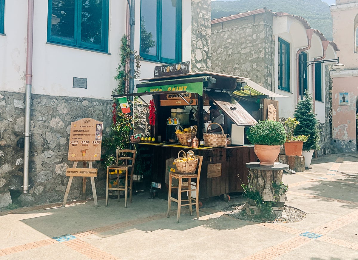
When you get to the bottom of the stairs, you’ll find a small town square – and this refreshment stand. Make sure you stop and get a lemon granita!
Then you can opt to hop on a bus back to Amalfi, or even continue your hike all the way down to Positano. Keep reading for all the options!
Getting to the Start in Bomerano
The Path of the Gods begins in the town of Bomerano. So how do you get to Bomerano to start the hike? Great question that we spent entirely too much time figuring out.
So let me make this easier for you than it was for me. There are really just two options for getting to the trailhead – bus or taxi/car service.
Getting from Amalfi to Bomerano
Option 1: Take the SITA bus from Amalfi to Bomerano.
The SITA Bus (~45 minute bus ride) is the most popular and inexpensive option for reaching the trail, but there are a few catches. First, you will need to check the bus timetables during your visit. When we were there, the earliest bus was 10:00am, which is very late to start a hike.
There can also be some issues with overcrowding on buses during the peak summer season, which may mean you have to wait for several buses to pass before you find one that you can squeeze into.
If you do opt for the bus, be sure to buy your bus tickets ahead of time, as you can not always purchase them on the bus itself. You can ask for assistance at the bus depot, which is near the ferry dock. This website is a good resource for SITA bus routes and ticket info.
Option 2: Get a taxi or car service from Amalfi to Bomerano.
If you do not want to utilize the bus, the only other way to reach the trailhead is by car or taxi service. The car ride is ~30 minutes. We opted to have our hotel arrange a car service to drop us off at the trailhead and pick us up again at the end. This was expensive but very efficient.
Getting from Positano to Bomerano
Option 1: Take the SITA Bus to Amalfi. Then take another bus to Bomerano.
There are no bus routes that will take you from Positano to Bomerano directly. So if you wish to use the bus system from Positano, you will need to reach the town of Amalfi first via SITA bus (~1 hour bus ride). Then you can continue with the directions above for taking another SITA bus from Amalfi to Bomerano (~45 minute bus ride).
Option 2: Take the ferry to Amalfi. Then take another bus to Bomerano.
Alternatively, you can take the ferry (~20 minute ferry ride) from Positano to Amalfi. The ferry ride is quicker than the bus ride to Amalif! Then once again, you can continue with the directions above for taking the SITA bus from Amalfi to Bomerano (~45 minute bus ride).
Option 3: Get a taxi or car service from Positano to Bomerano.
Alternatively, you can hire a taxi or car service to take you from Positano directly to Bomerano (~1 hour drive). This will be more expensive, but will save you a lot of time and aggravation.
Option 4: Hike the trail in reverse.
There is a local bus service between Positano and Nocelle (the ending point of the hike). For this reason, some hikers staying in Positano choose to hike the trail in the other direction – starting in Nocelle and ending in Bomerano.
The views are not as good this way, which is why this option isn’t too popular, but it does help ease logistics. Another option is to start in Nocelle and hike the full trail both ways – Nocelle to Bomerano and back to Nocelle again.
Getting from Sorrento to Bomerano
Option 1: Take the SITA Bus to Amalfi. Then take another bus to Bomerano.
If you wish to reach Bomerano by bus, you will need to make a connection in another town, with Amalfi being the easiest option. Take the SITA bus from Sorrento to Amalfi (~1 1/2 hour bus ride). Then take another SITA bus from Amalfi to Bomerano (~45 minute bus ride).
Option 2: Take the ferry to Amalfi. Then take the SITA bus to Bomerano.
Alternatively, you can take the ferry from Sorrento to Amalfi (~1 hour ferry ride), which is faster and more enjoyable. Then, continue with the same directions as above to take the bus from Amalfi to Bomerano (~45 minute bus ride).
Option 3: Get a taxi or car service from Sorrento to Bomerano.
Alternatively, you can hire a taxi or car service to take you from Sorrento directly to Bomerano (~1 hour drive). This will be the quickest but most expensive option.
Getting from Other Amalfi Coast Towns to Bomerano
If you are staying in another Amalfi Coast town, your best option is to connect to Amalfi via ferry service and then take the SITA bus from Amalfi to Bomerano. Travelmar sometimes offers combination ferry + bus tickets to reach Bomerano in the summer months, so that is worth checking out for some cost savings.
Of course, you always have the option of using a taxi or car service from any town. This is always the most convenient option, but has a price tag to go along with that.
The Ending Point in Nocelle (and getting back!)
When you reach the ending point of the trail in Nocelle, you will find a pretty square and a refreshment stand that sells lemon granitas. I highly recommend you sit for a few minutes here and enjoy one!
But now how do you get back from Nocelle after hiking? Well at this point, you have two options.
If you are finished hiking, you can catch a bus to Positano (via the smaller bus company Mobility Amalfi Coast). Once you are in Positano, you can use the ferry system or SITA bus to connect to Amalfi or any of the surrounding towns.
If you have arranged for a car service to pick you up, they will need to meet you near the bus stop, which has a small parking area, so you can follow the signs for the buses to find your driver.
But if you are not finished hiking quite yet – there are a couple options to extend your hike! Let’s look at those next.
Continuing the Hike from Nocelle to Positano
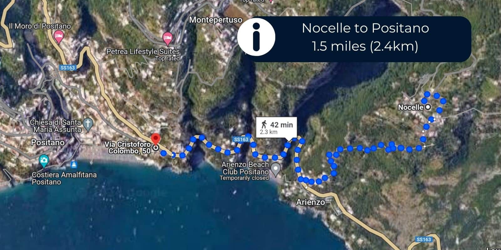
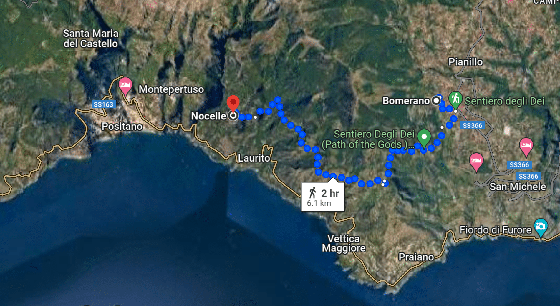
If you would like to continue hiking all the way to Positano, you can walk the ~1500 stairs down from Nocelle to the small town of Arienzo, roughly 0.9 miles (1.4 km). From Arienzo, you can continue walking along the roadway to Positano, which is another .6 miles (1 km) more. So in total, this adds about 1.5 miles (2.4 km) to your hike.
While this doesn’t seem too far, remember that you are hiking down some very steep steps. For most hikers, it will take about one hour to reach Positano from Nocelle. (You can follow this map!)
Once you reach Positano, you can connect to Sorrento or any of the other Amalfi Coast towns by ferry. But I highly recommend you spend a little time exploring Positano first. Grab some lunch and perhaps spend some time at one of the famous beach clubs!
Continuing the Hike from Nocelle to Montepertuso (and then to Positano)
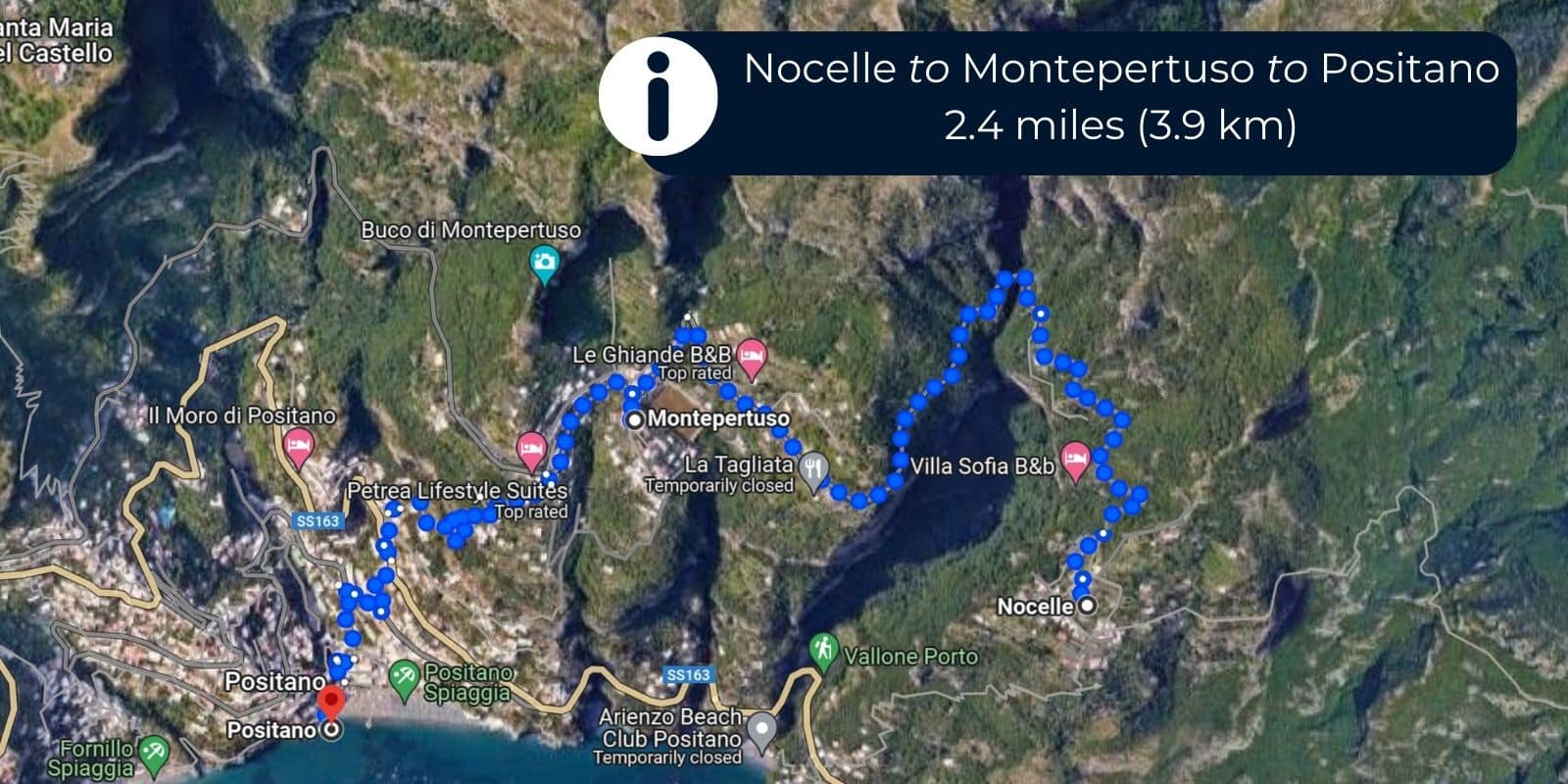
Another popular option is continue hiking from Nocelle to Montepertuso, This adds about 1.4 miles (2.5km), if you hike to the town center. (You can follow this map.)
But if you stop a bit short of that, at about 1 mile (1.7km), you will find the Instagram famous La Tagliata restaurant. This is the main draw for hikers that head this way! It makes for a great lunch stop after a long morning hike. Be sure to make a reservation in the busy season – this place is very popular.
After visiting La Tagliata and the town of Montepertuso, you can walk down to the town of Positano below. If you walk all the way down to the ferry dock, that will be about 1 mile (1.6 km). It involves some serious steps, and will take you around 40 minutes.
If you’re done walking at this point, there is also a local bus that runs seasonally between Montepertuso and Positano that you can try to catch. Or La Tagliata sometimes offers a shuttle service if you dine there – but I suggest you call ahead and make sure it’s running.
From Positano, you can connect back to Sorrento or any other Amalfi Coast town via the ferry.
In total, if you hike the full way from Nocelle to Monteperuso and then on to Positano, it adds about 2.4 miles (3.9 km) to your hike.
What to Wear – Shoes & Clothing
First, let’s talk shoes. What kind of shoes do you need to hike Path of Gods? I recommend a pair of trail runners with some decent tread on them.
I personally hiked in my Altra trail runners and they were perfect. They gave me a little grip for the slippery areas or the few spots where we had to scramble over rocks. True hiking boots are not needed – the trail is not that intense.
As for clothing, you will want to wear comfortable athletic attire. And I suggest dressing in layers if it’s chilly in the morning. I wore a lightweight hoodie when we set out, but was comfy in my athletic shorts and tank top within the first hour.
What to Bring
The hike isn’t all that long – only about 2 hours for most people – so it’s not necessary to bring too much gear along with you. I carried this drawstring backpack which I take on all my travels, along with:
- Water – Bring at least one liter per person.
- Snacks – Granola bars, apples, and bananas are easy to pack.
- Sunscreen – The sun is intense!
- Bug Spray – The wooded areas had mosquitoes – I like these bug spray wipes for travel.
FAQs about Path of the Gods
Where does the Path of the Gods start and finish?
The Path of the Gods trail starts in Bomerano and ends in Nocelle, with options to continue hiking all the way to Positano.
Which direction should you hike Path of the Gods?
You should hike the trail westbound from Bomerano to Nocelle. While it’s possible to hike in either direction, the westbound route has more downhill elevations and much better views as you walk towards Positano.
How long does it take to hike the Path of the Gods?
Most hikers complete the hike from Bomerano to Nocelle in 2 – 2 1/2 hours. If you plan on hiking all the way to Positano, plan for at least one more hour (see more details about that option in the article above).
How difficult is the Path of the Gods hike?
It’s considered a moderate difficulty level. Much of the trail is on dirt paths, but there are some rocky areas and a few places that require scrambling over rocks. But honestly, my family found it to be pretty easy, even for my eight year old. It was significantly easier than our hikes in the Grand Canyon.
Can you hike Path of the Gods with kids?
Yes, we hiked it with an eight year old and saw other families on the trail as well. You need to be cautious in places with steep drop offs and small kids may need assistance climbing over the rocks in some areas. I would be hesitant with a wild toddler, but most older kids that can follow instructions will be fine.
Do you need a guide to hike Path of the Gods?
No, and I would recommend against hiking with a tour group. The trail is very easy to follow with plenty of signs – you can’t get lost. It’s best to go at your own pace and have a bit of space from other groups.
However, if you prefer to have a guide anyway, I recommend opting for a private hike that includes hotel pickup. This will take care of the early morning logistics and having a private group will mean you aren’t tied to other people’s timelines. This tour has been recommended by several readers.
Where should you stay to hike Path of the Gods?
Amalfi is the best place to stay for hiking the Path of the Gods, because it has the most consistent bus service to the trailhead in Bomerano. Amalfi is easily reached by ferry from Sorrento and any of the other Amalfi Coast towns.
So… is the Path of the Gods worth it?
Yes! Unequivocally, yes. We actually considered skipping this hike, because we found the logistics a little overwhelming. But it turned out to be one of our favorite activities on our whole Amalfi Coast vacation!
In hindsight, if we were to do this hike again, we would continue hiking all the way to Positano rather than stopping in Nocelle. We found that the trail was much easier than expected and would have liked to keep going if we hadn’t already arranged a car service.
(I would still keep the car service to the starting point though, as that is the quickest way to get there and the only way to reach the trailhead in the early morning hours).
More Amalfi Coast Trip Planning Resources
If you’re planning an epic trip to Italy’s Amalfi Coast, be sure to check out these other helpful resources: